Some people like to travel with a plan. I enjoy the open road and while I generally have a destination for my travel, the route sort of finds me along the way.
There are essentially three main routes for traveling between Seattle and California.
- Interstate-5 is the fastest in drive time from Seattle to Redding and runs through 175 miles of forest covered hills from Seattle to Portland, through 125 miles of the flat agricultural Willamette Valley of Oregon where the capital city Salem and the University of Oregon city Eugene are located and then back into 300 miles of woods and hills to Medford and Mt. Shasta and to Redding, California at the head of the big, mostly flat Central Valley of California.
Â
- Highway 101 runs along 300 miles of the Oregon coast with iconic ocean views for rock outcrops jutting up from the sea. I live by Highway 1 in Monterey just a few miles from the Big Sur section of the Pacific Coast Highway. From vast experience I know that two unpredictable factors can obscure the views at any moment along the coastal drive: the fog and the motorcoaches.  The pleasure factor of the coast drive is somewhat a matter of luck and timing for whether your fate will be averaging 40 mph for 8 hours of drive time or 30 mph for 10 hours of slower drive time. This is a drive where you don’t want time constraints.
Â
- U.S. Highway 97 is volcano alley. I was totally unfamiliar with this route before this past week and this road is probably the road least traveled by sightseers, yet is likely the road with the most visible geographic features unique to this part of the world. Highway 97 is a major Pacific Northwest thoroughfare running along the eastern side of the Cascade range in the high desert plateau of central Oregon and Washington from the Canada border with Washington to the small town of Weed at the base of Mt. Shasta in northern California. Even though the country changes name at the U.S. border, the road name remains the same. British Columbia Highway 97 runs another 1,293 miles north through British Columbia to the Yukon.
Â
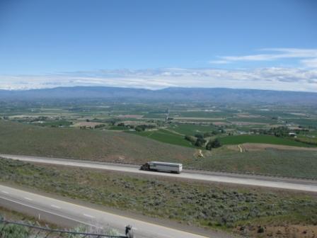
I traveled through Washington and Oregon on a sunny mid-June day with temperatures mostly in the low 70s. Driving Highway 97 across the high desert is one of the most scenic roads with eye-popping vistas of mountains beyond mountains that I have seen. I’ll let my drive-by pictures reveal scenes from the road.
Mt. Rainier is huge at 14,411 feet, so how did I miss it?
The weather newscaster commented on the fact that June 16 was the first sunny morning in about two weeks for the Seattle area. A Mount Rainier drive-by was my initial plan.
I drove out of Seattle without a map under not so sunny skies. Thinking I had a map of Washington in my car was my first mistake. My primary objective was inspired by an idea to stay off the Interstate highways and take local roads as much as possible. Getting across Lake Washington seemed to be the first obstacle and for that portion I conceded to drive I-90 East. Not exiting to I-405 South was my second mistake. There are no signs on I-90 saying Mt. Rainier National Park and there are only a couple of access routes. I quickly drove past all of them. Â
Mount Rainier is a sizeable mountain at over 14,000 feet and I just figured I would run into it if I drove southeast from Seattle.
I didn’t.
I was going by memory and Cle Elum sounded like the town I wanted to be driving to when actually I had meant to be driving to Enumclaw. These two towns are closely related towns in name-only with their component phonemes (sounds).
I guess I am the kind of guy who doesn’t ask for directions. Or stop to use my smart phone maps.
The locations of Cle Elum and Enumclaw Washington are about 85 miles apart from each other by road geographically with Mount Rainier and snowbound roads posing a major obstacle for road travel between the two locations.Â
I finally stopped to ask for directions at the Best Western Plus Snowcap Lodge in Cle Elum 83 miles out of Seattle. The kind woman at the hotel gave me a map of Washington State and directions to go west about 50 miles if I wanted to go to Mt. Rainier National Park. I don’t know if I ever let on that I drove in from the west.
I didn’t back track toward Seattle.
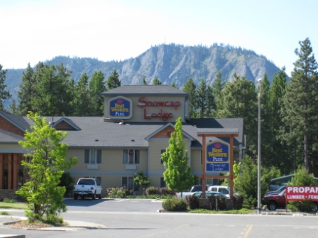
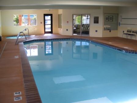
Best Western Plus Snowcap Lodge is a convenient hotel location with a big Safeway market across the street, Burger King and a couple of restaurants nearby. AAA room rates for Thursday June 23 are $90 for a King Bed Suite to $117 for King room with deluxe furnishings. I didn’t see the rooms though now I am interested in knowing more about deluxe furnishings. Weekends are $102 to $127 for Saturday June 25.
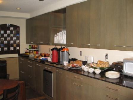
The hotel has an indoor pool, spa tub and small fitness room with a fireplace in the lobby. The hotel looked like a great location for a stop when traveling this route. A major Safeway market with its own gas station and discounted gas for Safeway Club card members is a convenience right outside the door for food access no matter what the weather conditions any time of year. No need to get back in the car when looking for food in this roadside spot.
Turns out Enumclaw, Washington wouldn’t have helped me easily get to Mt. Rainier National Park anyway. Highway 410 still isn’t cleared of snow for another couple of weeks. Apparently, I should have driven south on I-5 and taken Highway 12 east through Mt. Rainier N.P. and over to the east side of the Cascades.
There is always another time when hopefully I have more time than a simple drive-by to enjoy Mount Rainier.
“It seems like years since it’s been clear. Here comes the sun.†– George Harrison
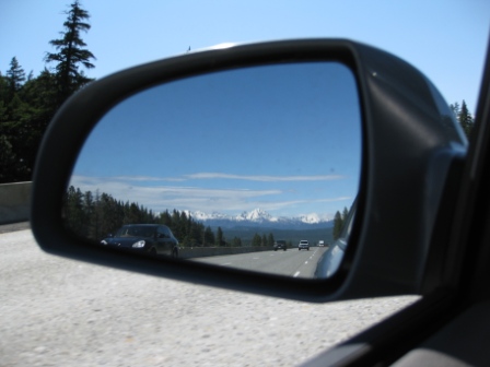
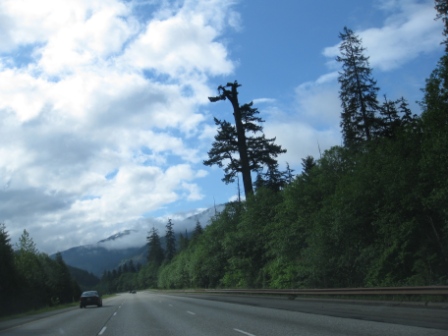
Soon after leaving Cle Elum and heading uphill on Interstate-90, I was blown away when I looked in my rearview mirror to see this sight.
Normally I wouldn’t pull off to the side of the road on an interstate highway for a non-emergency situation. This was an emergency photo opportunity. I had one brief glimpse of mountains beyond mountains on Sunday night in Vancouver when the air cleared and the mountain vista from a city skyscraper window opened up for miles. This is the clearest sky I had seen in two weeks of travel in the Pacific Northwest.
I think these are the Enchantment Peaks seen from just a few miles east of Cle Elum on I-90. Does any reader definitely know this mountain range and the name of the main central peak?
Kittitas Valley, Washington
The town of Roslyn is a few miles north of I-90 and along with Cle Elum form the northern end of the Kittitas Valley region. Roslyn is a small town famous for having the oldest continuously operating tavern in the state of Washington – The Brick, open since 1898. The Brick saloon exterior and scenes for the town of Cicely, Alaska in the early 1990s TV show Northern Exposure were filmed in Roslyn.
My wife and I had a good drinking day at The Brick in June 1992. I skipped Roslyn on this drive.
I-90 goes into Kittitas Valley on the east side of the Cascades where trees are replaced by grasslands. The valley is an expanding wine region with 90 wineries in the valley area, but wind power caught my attention. This is apparently one windy location with a recently built Kittitas Valley Wind Power Project visible from the freeway.
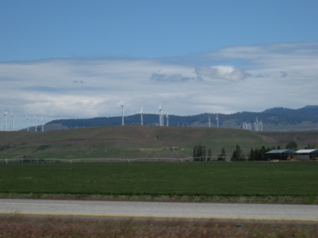
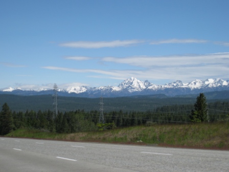
Washington and Oregon Department of Transportation officials must have realized too many people were pulling off to sides of roads for photos or driving recklessly while taking photos since I learned through the day that rest areas and vista points with mountain identifier signs are common along the roads.
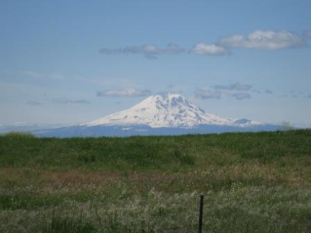
After two weeks of mostly cloudy weather in the Pacific Northwest, I was ready for sun. Crossing to the east side of the Cascades put me in sunshine the rest of the day. Eventually I did see Mount Rainier and so many other prominent peaks of Washington and Oregon – from a distance.
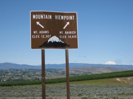
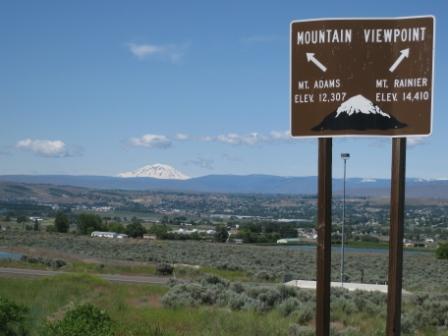
All in all, I found Mt. Adams to be the most visually stunning peak in Washington even though it is 2,000 feet lower than Mt. Rainier. I drove along Interstate 82 to Yakima where I picked up Highway 97 south.
The Road I Missed
Between Ellensburg and Yakima, Washington is State Route 821 that runs 18 miles through the Yakima River Canyon is a scenic byway.  The canyon has 2,000 feet basalt cliffs and the densest population of  nesting bald eagles, falcons and hawks in Washington. I learned these road facts at the Selah Creek Rest Stop by Yakima where I took the Mt. Rainier and Mt. Adams photos. I would have had to backtrack north to drive SR 821.
I drove south.
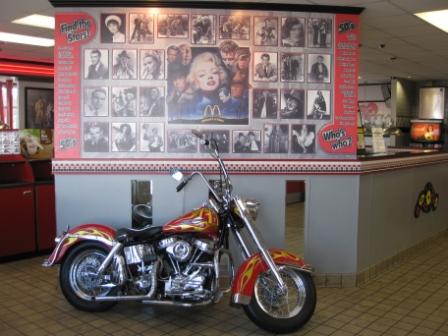
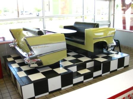
This is not your grandfather’s McDonald’s
Generally I would not have much reason to mention a classic American institution like McDonald’s on Loyalty Traveler, but I needed a place to change from jeans into shorts in Yakima with the temperature rising 25 degrees from 48â°F to 73â°F since Cle Elum (actually probably less than 40 degrees in Cle Elum if factoring wind chill from the brisk gusts). A $1 soda seemed like a refreshing idea too.
I don’t visit enough McDonald’s to know if this place is unique, but I certainly hadn’t seen one like it before.
The entire McDonald’s has a 50s theme with Elvis, juke boxes at the tables, a motorcycle, classic car booths, and guys and gals on the bathroom doors. This is not the kind of McDonald’s I grew up with as a kid in the 1960s.
This McDonald’s is actually in Union Gap, a southern suburb of Yakima that was officially the town of Yakima in the 19th century until the railroad depot built nearby in the 1880s resulted in the town of Yakima losing its nameplace to the bigger North Yakima town in 1918.
Gotta admit that free internet at McDonald’s was a genius marketing move. That service pulls me in from time to time, although I find the free internet available in many hotel lobbies provides a more comfortable and often kid-free environment for my needs.
Yakama Nation Reservation
Highway 97 cuts across the Yakama Nation Indian Reservation. In retrospect, I wish I had stopped by the Yakama Nation roadside museum in Toppenish, about 14 miles south of Yakima on Highway 97. I have been to several Indian Reservations over the course of my life and the history is a sad stories of broken treaties between the U.S. Government and the indigenous peoples with forced lifestyle changes. Yakama Nation sounds like a similar tale from the little I’ve read.
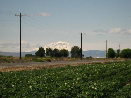
Mt. Adams comes into closer view from Yakima, Washington where Highway 97 separates from eastbound Interstate 82.
Names are spelled differently with an “i†used in Yakima Valley place names and replaced with “a†for Yakama Nation Reservation lands bordering the east side of “Pahtoâ€, the Yakama Nation name for Mount Adams.
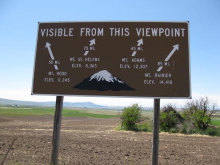
Just south of Goldendale is a highway marker showing several volcanic mountains.
I ended up talking to these local area people heading to the coast from Yakima and I forgot to snap any photos of the mountains. They gave me a map of Oregon which was the second kindness of the day after being given the map of Washington for this directionless navigator.
The strangers also told me driving Highway 197 from The Dalles, Oregon was a more scenic road than staying on Highway 97. My afternoon drive shifted at a moment’s notice to an entirely different route.
I couldn’t see Mt. St. Helens from the signpost spot. I had taken photos of Mt. Adams within a mile north of the Highway 97 volcano viewpoint marker just south of Goldendale.
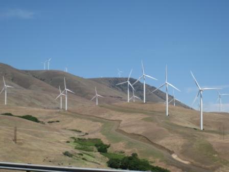
Turns out that Washington and Oregon are currently the largest wind power projects in the U.S. There is an LA Times article this week citing the conflict between the Bonneville Power Company of the Columbia River power administration and the wind farms in the Goldendale area.
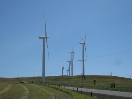
The wind power facilities were ordered into partial shutdown over the past few weeks with too much electricity being generated right now for the grid due to the high Columbia River basin runoff from 25% more snow than average this past winter.
Â
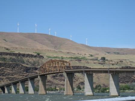
Columbia River Gorge
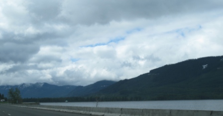
The Columbia River drains the Cascades water and snow melt into the Pacific Ocean. The gorge has a wind tunnel effect that was so strong on the day I drove along the river that the water appeared to be moving west to east.
The Columbia River is the sixth largest river in North America by volume of water runoff. Only the Mississippi River in the U.S. has a larger runoff. June is usually the peak month for river runoff. The river starts in the British Columbia Rockies and creates the border between the states of Washington and Oregon.
Around 6% of the water from the Columbia River Basin runoff is diverted to agricultural fields in the arid portions of eastern Washington and Oregon and southern Idaho.
One of the sadder facts I learned about the Columbia River is the 1957 opening of The Dalles Dam flooded the oldest continuously inhabited villages in North America at Celilo Falls near this area. Another treaty with the Yakama Nation broken with a cash payout of something like $30 million.
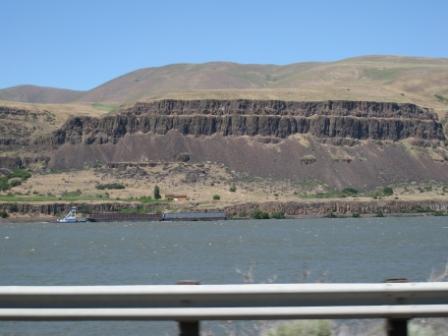
A fishing spot for 15,000 years was submerged under the rising water created by The Dalles dam.
The dams on the Columbia River submerged the series of rapids in this area to make the river more navigable and provide electricity and water for the Pacific Northwest and as far as southern California.
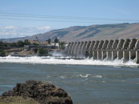
The Bonneville Power Administration is a part of the U.S. Department of Energy and controls the energy sources from the Columbia River projects. Basically BPA is in the business of selling power to private utility companies. The company produced an 80-page document describing the Columbia River hydroelectric power development in detail, The Columbia River System Inside Story (April 2001) and is the source where many of the facts cited here are found. Grand Coulee Dam on the upper Columbia River is the largest  electricity producing project in the U.S. The Dalles Dam is the second to last major dam before the Columbia River reaches the Pacific Ocean near Astoria, Oregon.
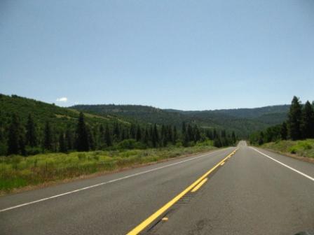
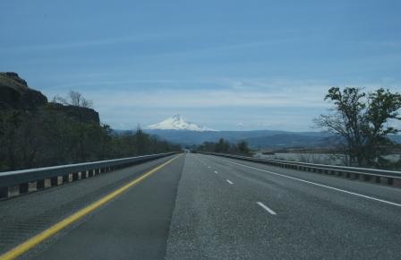
From The Dalles, I picked up Highway 197 called The Dalles-California Highway on Google Maps for a 60-mile detour into the high desert around the Deschutes River. Highway 197 takes a route closer to the major volcanic mountains of Oregon for better views than seen from the more eastern road of Highway 97.
(to come: Highways 197 and 97, The Dalles to Bend, Oregon)
(to come: Cascade Lakes Scenic Byway and Crater Lake National Park)

6 Comments
Comments are closed.