There truly are few roads crossing the canyonlands and mountains of Utah besides Interstates 80, 15 and 70 in the west and east directions. Historic transportation routes across the Great Basin deserts are relatively close to present-day Interstate 80 and Highway U.S. 50.
Getting off the interstate for much of the road trip across the deserts from Colorado to California was one of my objectives during the July 2011 road trip I dubbed Brokeass Mountain Tour.
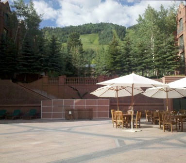
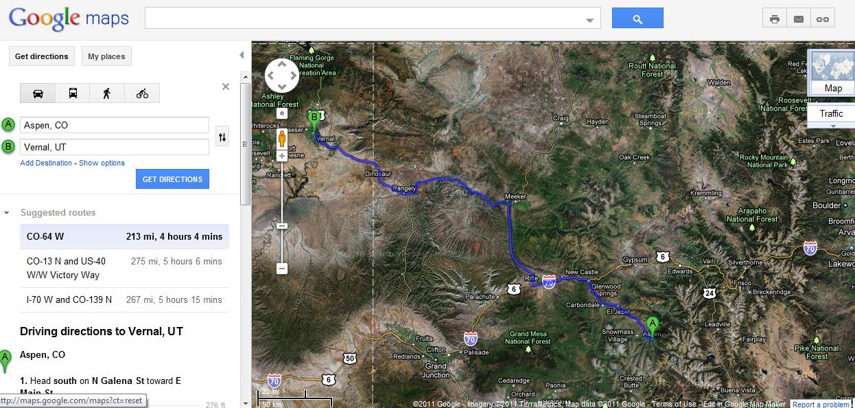
After one night at the St. Regis Aspen we drove Interstate 70 for 27 miles west from Glenwood Springs to Rifle, Colorado where I headed north on two-lane Colorado State Highway 13, rather than drive Interstate 70 west into Utah.
Colorado Highway 13 travels through high country cattle grazing land loaded with elk crossing signs, although we didn’t see any elk, only cattle on this drive.
My objective was connecting to US Route 40, the major east-west highway across northern Colorado. Forty miles north of Interstate-70 is Meeker, Colorado and we turned onto Colorado State Highway 64 and followed the White River flowing west. The road had recently been scraped clean of mud and Flood Warning signs were still posted along the road. Record breaking rainfall had hit the Rocky Mountains just two days before in places like Breckenridge and Aspen. The road looked like the rains had washed mud from the mountains right across the road for several miles.
”] Meekeris one of those small towns with a significant history. A battle between the Union Army and the Ute Indians in September 1879 resulted in the tribal lands being confiscated and the removal of the White River Utes of Colorado to the Uintah and Ouray Indian Reservation in northeastern Utah. This reservation is located in eastern Utah between US Route 40 and Interstate 70.
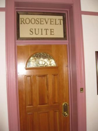
The historic Colorado Hotel in Glenwood Springs has a Theodore Roosevelt Presidential Suite.
Apparently T.R. also did some mountain lion hunting based out of Meeker, CO.
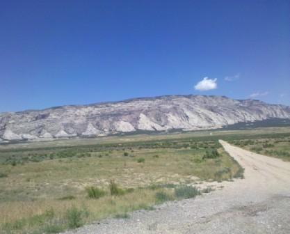
An aerial view of the White River Valley around Meeker and the “China Wall” reveals the ruggedness of the western Colorado outback.
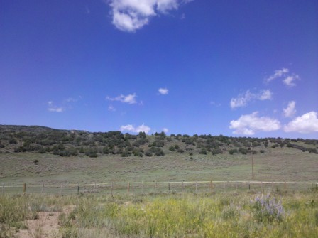
Highway 64 follows the White River through the western Colorado outback. This is the wild west where there aren’t many towns or people or paved roads. The realization that there are thousands of miles of paved road connecting small towns dozens of miles apart across the western U.S. created an alluring appeal for me to explore these sparsely populated places of hidden beauty that are bypassed by the vast majority of travelers on an interstate journey through Colorado and Utah.
Throughout my life I learned plenty of history from song references and one of the songs that connected with me during this drive from Colorado to Utah is Bob Marley’s “Buffalo Soldier”.
Buffalo soldier in the heart of america
then you would know where you coming from.
~Bob Marley – Buffalo Soldier
Buffalo Soldiers were involved in the 1879 relocation of Utes from the White River region of Colorado to the Uintah and Ouray Reservation in Utah. Henry Johnson was a Buffalo Soldier recipient of the Medal of Honor for actions at the Milk River Battle in Colorado 1879. Here is a fascinating historical lens to the Indian Wars and Colorado from an October 3, 1879 New York Times article describing the White River 1879 problems with reference to a buffalo soldier military unit in Colorado.
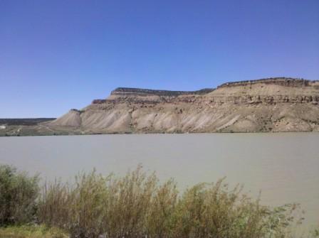
Kenney Reservoir on Highway 64 near Rangely, Colorado.
Future western states road trips will likely be solo since exploring the remote west is not such an alluring trip ticket for my wife who would much rather be exploring the historic cities of Europe.
The Colorado Plateau
The Colorado Plateau extends from the Grand Canyon region of Arizona in the southeastern portion of the Plateau to the Green River canyons of northeastern Utah and Yampa River in northwestern Colorado where the rivers converge at Dinosaur National Monument park.
The Green River is the largest tributary river to the Colorado River from its source in the Wyoming Rocky Mountains where it drains the high plateau on a course through Utah.
Driving I-70 east into Colorado Kelley and I figured Fruita, the first city where we drove adjacent to the flooded Colorado River, was a place for growing fruit, but why was Grand Junction, named Grand?
The AAA guide suggested Grand Junction’s name was due to its transportation junction location. Turns out the Colorado River from its headwaters in the Rocky Mountains to where it joins the Green River in Canyonlands National Park, Utah was named the Grand River up until 1921 when Edward T. Taylor, U.S. Representative from Colorado introduced a resolution to rename the headwaters section of the river in the state of Colorado as the Colorado River.
The Green River has a much larger watershed than the Colorado River before they converge at Canyonlands National Park in southeastern Utah. The Yampa River is the second largest river in Utah and primarily runs west from Streamboat Springs, Colorado to where it joins the Green River in Dinosaur National Monument.
Dinosaur National Monument
The area north of US Route 40 in northwest Colorado and northeast Utah is dinosaur country. The Dinosaur National Monument Quarry Visitor Center has been in a temporary structure since 2006 when the main center closed for safety reasons. The new Dinosaur Quarry Center rebuilt using funds from the Obama stimulus package American Recovery and Reinvestment Act of 2009 will reopen next week on October 4, 2011.
Traveling from Dinosaur, Colorado to Vernal, Utah reminded me of the economic divide we used to experience when living in Downeast Maine and crossing the border into Canada where the standard of living was visibly higher. Vernal, Utah has money, lots of major chain hotels, restaurants and fast food joints and the Utah Field House of Natural History State Park Museum for a chance to see dinosaur fossils and full size replicas without having to drive to the Dinosaur National Monument.
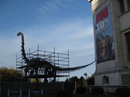
There were several good dinosaur models I saw in Vernal, Utah while driving through town, but no pictures. The photo above was taken outside the Field Museum during my trip to Chicago in October 2010.
The Uintah Basin, Utah
The Uintah Reservation of the Ute Indians runs through the Uintah Basin south of the Uintah Mountains where the highest peaks in Utah are located. This part of Utah is still sparsely populated and while predominantly a white citizenry, the largest town of Roosevelt was founded by homesteaders and not Mormons. The Uintah Basin was developed beginning in 1906 by homesteaders with paid claims who bought land within the Uintah Indian Reservation at $1.25 per acre allowed by the Dawes Act as a way to integrate Native Americans with the American emigrant population.
”] Fort Duchesne is the current administrative center for the Uintah and Ouray Indian Reservation, the second largest reservation in the U.S. Fort Duchesne was originally built and manned by Buffalo Soldiers for 25 years from 1886 to 1911. An article by Robert Foster from Wild West magazine February 2000 provides some history of Buffalo Soldiers in Utah Territory.
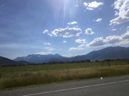
I never realized Utah had places with such green land in late July. This region of Utah is a strong contrast to the canyonlands of the southern regions of the state. Looking north to the Uintah Mountains provided some striking views of mountainous terrain that looked to be wild west wilderness to my eyes. Since I was driving west on US 40, I did not get any good photos of the high mountains to the north.
Park City, Utah
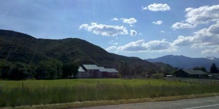
Highway 40 continues through the Uintah Basin and winds around Strawberry Reservoir, a major water conservation project and Utah’s most fished location. There was some thickly forested land in the mountains as we drove between the reservoir and Heber 23 miles north. The road drops down from the mountains into Heber located in a lush valley surrounded by the Wasatch Range of mountains separating Heber from Provo and Salt Lake City.
Park City is the year round world class sports resort on top of the eastern slopes of the Wasatch Range peaks, just a short 30 minute drive from downtown Salt Lake City.
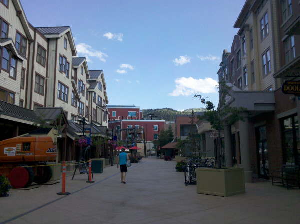
Park City was crowded with car traffic as we approached the historic downtown area, yet the tourist center was totally dead. Walking empty streets gave an eery feeling on a nice July afternoon. Kelley thought I had booked a resort in Park City, but I hadn’t since she had complained about altitude sickness after feeling nauseous  for our entire stay in Aspen.
I took that as a sign I should avoid another night keeping her at 7,000 feet in altitude so I took advantage of a Priority Club Pointbreaks hotel for 5,000 points at a Holiday Inn Express in Salt Lake City. That was a $30 night in points cost rather than blowing my free SPG Resort night at the St. Regis Deer Valley in Park City or 15,000 Gold Passport points for the Hyatt Escala Lodge Park City. Waldorf Astoria Park City had published rates at $109; far lower than Starwood or Hyatt paid rates.
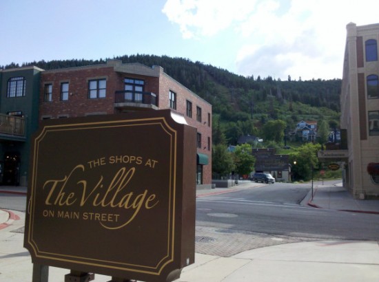
The Village, Park City Utah on dead action July afternoon My plan was to hang around Park City for about three hours taking photographs of the major resorts, but Kelley vetoed that Loyalty Traveler assignment. She asked me to take her to our hotel and then I could ride a bike down a ski slope by myself and bar hop all over Park City if I was still feeling like an Olympian.
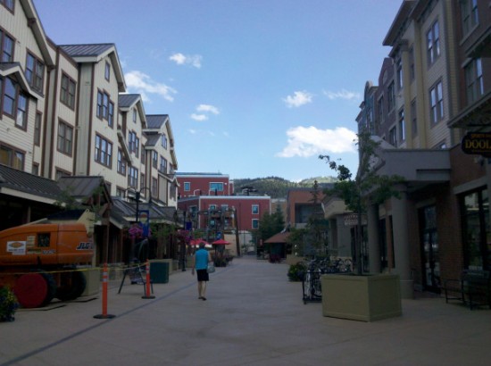
Marriott Vacation Club Summit Watch Park City Kelley was under the impression we were staying at a resort in Park City when I parked the car downtown and took her to the lobby of the Marriott Vacation Club Summit Watch. When she realized I was just taking pictures of resorts and I told her we would stay at the Holiday Inn Express in Salt Lake City she was relieved, and so was I that she wasn’t disappointed about not staying in a Park City resort hotel. She wanted to be out of the 7,000 ft. high altitude mountains of Park City ASAP.
All I can say to my readers who would have liked to learn more about Park City is that I was disappointed at being in one of the great ski resorts of the USA and unable to properly tour the town. I am planning to drive another road trip at my leisure and likely will pass through Park City, Utah again next June when I travel to Keystone, Colorado for Travel Blog Exchange 2012 Conference.
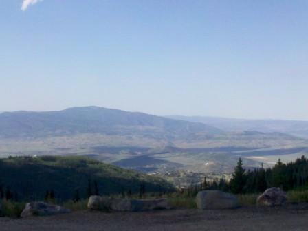
The view from above Park City, Utah Feeling kind of miffed about my aborted tour of Park City I proceeded to drive the road up the mountainside from Park City with every intention to drive Highway 190 across the Wasatch Mountains to Salt Lake City and bypass Interstate 80. And I might have made it too if there was better road signage on those mountain slopes. At about 9,000 feet I hit unpaved road with huge potholes and abandoned my mountain road route to Salt Lake City.
View from above Park City, Utah 
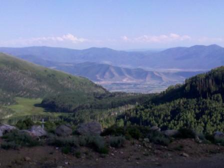
Empire Pass above Park City Any locals to Park City reading this blog? Give me a clue in the comments as to where I missed Highway 190 when I was at Empire Pass above Park City.
I backtracked down the mountainside to Park City and drove the Interstate-80 freeway to Salt Lake City.
Kelley really liked those Holiday Inn Express breakfasts on this trip so it is probably best we didn’t stay at the St. Regis Deer Valley or Waldorf Astoria in Park City where the price of breakfast would not fit my brokeass mountain budget. In retrospect, I think the Hyatt Escala Lodge breakfast, complimentary as a Hyatt Gold Passport Diamond member, would have likely impressed her more if she would have been feeling well enough to eat in Park City. Her appetite was much better the next morning in Salt Lake City once we dropped back down a few thousand feet from the mountain slopes of Park City.
For readers I guess the thing to keep in mind is be prepared for some queaziness when you decide to travel to a ski resort at 7,000 feet or more if that is not an altitude you are acclimated to function in.
We had a decent stay at the Holiday Inn Express Salt Lake City. While swimming in the outdoor pool we met a couple from Nova Scotia who had driven cross country to Vancouver and down the Pacific Northwest coast to Eureka and back across I-80 to Salt Lake City on their journey home. They were asking for travel advice for Indiana. Sorry, not my expertise.
We shared stories of northern California with Kelley and I having lived in Eureka for nearly a decade and also Downeast Maine tales from our two years around Acadia National Park when we also had the ability to travel a bit around the Canadian Maritime Provinces.
All Mod Cons at HI Express Salt Lake City for 5,000 Priority Club Points. Salt Lake City was under a smog alert for the day we headed west out of the city. What a shame that a city in such a remote location has air pollution reminiscent of Los Angeles. We packed up and headed out to the clear air of eastern Nevada, just another 30 hours from getting home to Monterey.
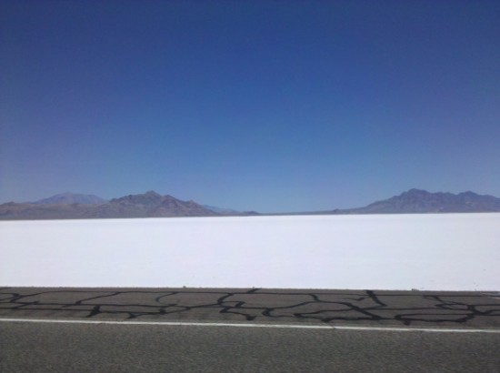
Utah salt flats 50 miles west of Salt Lake City Brokeass Mountain Road Trip, July 2011
Monterey, California – Denver, Colorado
- Yosemite’s Tioga Pass Road across the Sierra Nevada Mountains
- Westin Monache Resort Mammoth for year round vacations
- Even Lonelier than the Loneliest Road in America
- Earth’s Oldest Trees in Great Basin National Park Nevada
- Less extreme than 127 Hours in Utah
- Brokeass Mountain Tour eastbound – Hotel Value at High Elevation
- Brokeass Mountain Tour visits Starwood in Denver
- Driving by the 14ers South Park to Aspen, Colorado
- Top of the Rockies on the High Road to Aspen – Independence Pass 12,095 feet.
- St. Regis Aspen – Too Late to Cancel
- Aspen, Colorado to Park City, Utah: Ghost lands of Buffalo Soldiers, Utes and Dinosaurs
- The California Trail across Nevada


8 Comments
Comments are closed.