California’s Central Valley heated up by mid-afternoon to 100 degrees as we drove through miles and miles of fruit orchards in rural irrigated countryside dotted with historic Victorian farmhouses.
Leaving the comfortable summer environment of 70 degree days in fog and sun on the Monterey Peninsula is always difficult when the weather hits upper 90s and low 100s in most of interior California heading to the Sierra Nevada.
Jackson, California is a gold rush era town founded in 1948. The town sits in the foothills of the Sierra at 1,217 feet. Past Jackson the road climbs steadily up the mountains. I figured the temperature would drop to 85 by the time I reached 4,000 feet. It was 87.
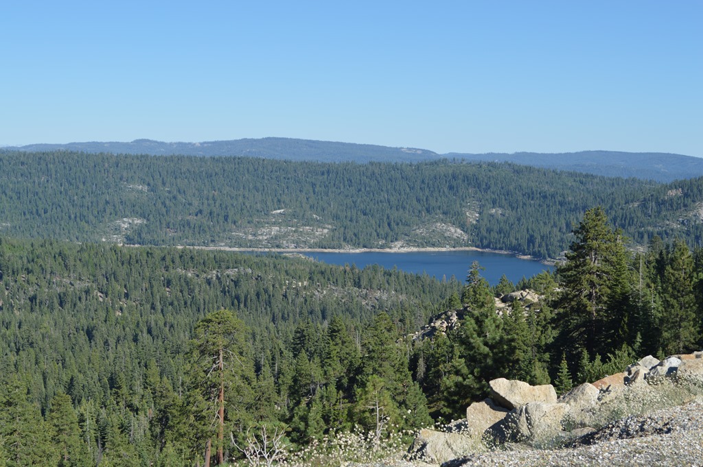
Peddler Hill Overlook Vista Point on Highway 88, Carson Pass, California.
A few miles past Peddler Hill there was a place on the ridge where there was space to see through the tall trees to the north and the Crystal Range mountains around Lake Tahoe. These mountains are right around 10,000 feet in elevation.
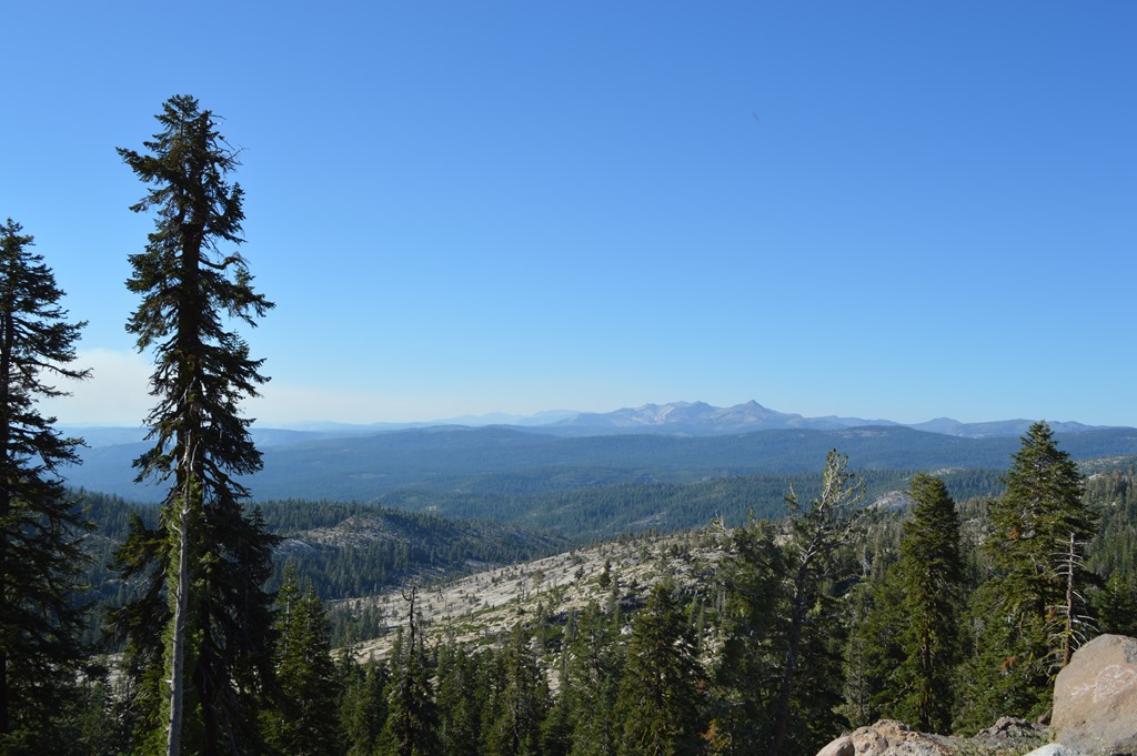
View of Crystal Range near Lake Tahoe from Highway 88, Carson Pass through Sierra Nevada.
Carson Pass is named after the American explorer Kit Carson who led the Fremont Expedition from Nevada to Sutter’s Fort, Sacramento in the winter of 1844 against the local Indians advice not to cross the mountain range in winter. The group survived the crossing without fatalities, but needed to eat many of their work animals along the way.
Interstate 80 from Sacramento to Reno is about 80 miles north of Highway 88. That road passes by Donner Pass where the infamous Donner Party events occurred in the winter of 1846-47.
Carson carved his name into a tree in the high Sierra during the 1844 crossing. That carving is now in a Sacramento museum and a marker commemorates the site of the former tree at the Carson Pass Information Center.

Kit Carson marker at Carson Pass Information Center.
Carson Pass also crosses the Mormon Emigrant Trail. Carson Pass was the main trail for supplies and pioneers across the Sierra Nevada during the Gold Rush era and up to the time the transcontinental railroad was completed following the Civil War.
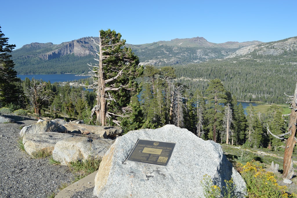
Mormon-Carson Pass Emigrant Trail historical marker. Silver Lake below.
Mormon-Carson Pass Emigrant Trail, the heavily-travelled gateway to California gold fields, was blazed in 1848 by discharged members of the Mormon battalion traveling east to rejoin their families.
Five hundred Mormon volunteers, recruited in Iowa, served one year in the Army of the West under command of Col. P. St. George Cooke during the war with Mexico. After their discharge in Los Angeles in July 1847, about 100 men worked in the Sacramento area for John Sutter over the winter to obtain needed supplies. When work was completed, 45 men and one woman (wife of Sgt. William Coray) turned their backs on newly-discovered gold fields and headed east for Great Salt Lake Valley. With 17 wagons, 2 cannons, 150 horses and mules, and 150 cattle, this organized party left Pleasant Valley July 3, 1848, following the drainage divide between the American River and streams to the south.On July 19 they found the common grave of three murdered comrades at a place they named Tragedy Spring (half-mile west of here). Following the ridge south of Silver Lake (viewed on your right) and obscured Squaw Ridge to the east, they crossed lofty West Pass at the foot of Melissa Coray Peak (9763 feet) on July 24. This pass and peak are seen ahead on the distant skyline. From West Pass (9550 feet), the 1848 route drops abruptly northward to Caples Lake, then eastward to Carson Pass (8550 feet).
In 40 days, this party blazed 170 miles of wagon road across trackless terrain, before joining the established California emigrant trail and heading east along the Humboldt River. Beginning in August of 1848, thousands of west-bound emigrant wagons followed these Battalion tracks on their westward crossing of the Sierra Nevada. The location of today’s Hwy. 88 north of Silver Lake and north of Carson Spur was opened with explosives.
Melissa Coray, then a bride of 18, walked beside her husband to California. The naming of Melissa Coray Peak honors not only the heroic pioneering efforts of Melissa and her party, but thousands of emigrant women who endured similar hardships in settling the West.
Site No. 52 Oregon-California Trail Association Dedicated July 30, 1994
There are mountain lakes throughout the Sierra Nevada and several along Highway 88.
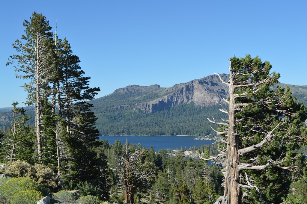
Caples Lake is a pretty location a few miles west of Carson Pass.

Dr. James Caples passed by this lake in 1849 on his way to Placerville, California. He returned to the lake with his family and set up a way station that served travelers for thirty years.

Carson Pass is around 8,500 feet in elevation. Carson Pass Information Center was closed when we arrived. Two groups of hikers on the Pacific Crest Trail adventure were hanging out here. They had started their trek the last week of April.
One of the easier high mountains hikes along the Pacific Crest Trail is heading north from Carson Pass Information Center for 12 miles with little elevation change to Echo Summit.
Fire on the Mountain
Descending the Eastern Sierra the smell of smoke was strong. The Bison Fire southeast of Carson City, Nevada was raging in the early evening winds. The sky was dark with plumes of smoke rising up furiously from the mountains and spreading high across the valley.
On Sunday, the Bison Fire was expected to be fully contained Monday. On Monday, it spread from 9.300 acres to 17,000 acres and containment is now not expected until July 14. This Tuesday morning the fire is now 21,000+ acres.
Our Pointsbreak room at the Holiday Inn Express Carson City has a view southeast to the fire about 20 miles away. Turns out the choice to take Highway 88 was a good one. Highway 50 to Carson City via Lake Tahoe was my alternate driving route and that highway was closed down yesterday due to another fire and smoke.

Smoke seen in the distance from Highway 88 is likely the Kyburz Fire that shut down Highway 50 over the Sierra Nevada yesterday.
Hopefully today there will be more pleasant sightings like wild mustangs in the Nevada desert.
Ric Garrido, writer and owner of Loyalty Traveler, shares news and views on hotels, hotel loyalty programs and vacation destinations for frequent guests.
Follow Loyalty Traveler on Twitter and Facebook and RSS feed

2 Comments
Comments are closed.